

Maps of Newport and surrounds.
Newport is nestled on the North Coast of Pembrokeshire in the UK. Nearest International Airport is at the Welsh Capital City of Cardiff. Bristol airport also has flights from various International Airports. Main Uk airports can be found a little further afield at Manchester and also at London Heathrow.
Map showing Newport Pembrokeshire in relation to south west Wales.
Trains arrive at Fishguard Harbour (7 miles) from Carmarthen many times a day and more often at Haverfordwest Station (27 miles). There are also ferries to and from Rosslare in Ireland, as well as to and from Pembroke Dock to Rosslare.
If you are looking to travel by train, why not book online with Train Line, they offer a large selection of options on their website here: Trainline website
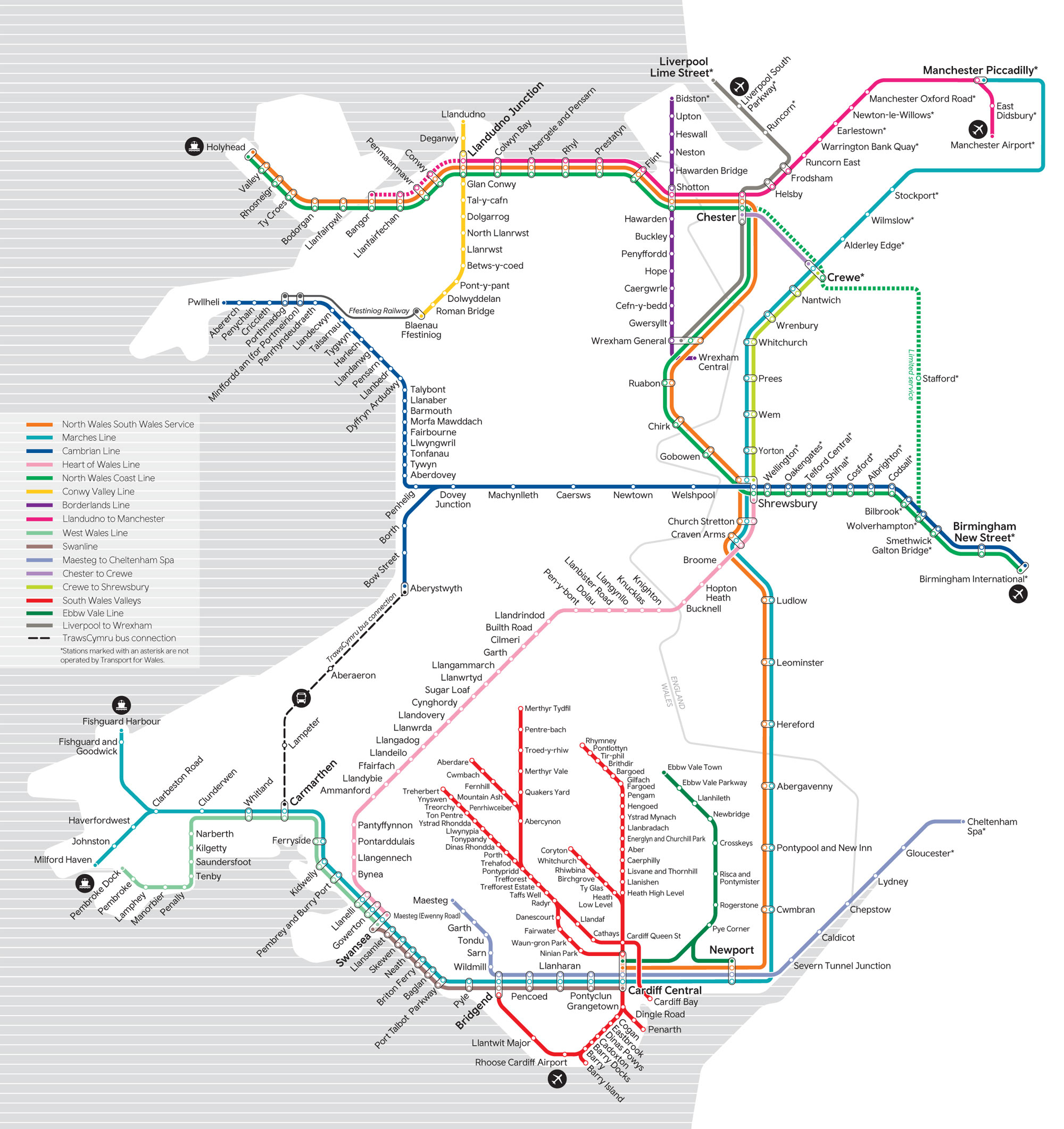
Below is a map of the train network across Wales. Please click / tap on it to view a larger version.
Situated in The Pembrokeshire National Park the Pembrokeshire Coastal Path runs through Newport and there are good local bus services connecting Newport with the rest of Pembrokeshire. The town sits on either side of the A487 making easy access from the North of Wales as well as from the East of the UK along the M4.
Map showing various free attractions at Newport Pembrokeshire.Map showing street layout of Newport Pembrokeshire.
External links to Maps of Newport Pembrokeshire..
- A vision of Britain through time Historical Newport maps.
- historicplacenames.rcahmw.gov.uk Historic Place Names Map.
- coflein.gov.uk Coflein Map.
- maps.nls.uk National Library of Scotland Maps.